Terrestrial Environments

What happens on land is important for reefs and marine environments, with nutrients and sediments coming off the land affecting nearshore environments.

CRRF collaborates with the USDA Forest Service Institute of Pacific Islands Forestry in Hilo, Hawaii and several other local partners, Ngardok Nature Reserve-Melekeok Conservation Network, Palau Forestry and the Belau National Museum, looking at several aspects of the terrestrial environments of Babeldaob Island, the largest island (400 sq km) in Palau and the second largest island in Micronesia. The field program has been run by Julian Dendy since 2011.

The program has three complimentary components:

LANDSCAPE CHANGE
FOREST DYNAMICS
FIRE MAPPING

Landscape Change – Why Study Landscape Change?

Knowing how landscape has changed over time provides valuable information for conservation land managers and for guiding community development and restoration efforts.

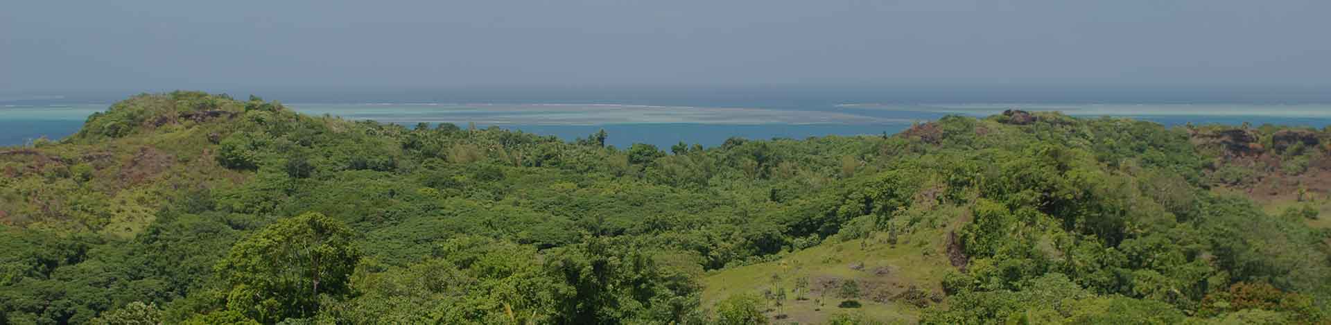
Babeldaob Island contains the largest area of intact native lowland forest in the Pacific. The forests of Babeldaob are the most diverse forests in Micronesia and are vital to maintain Babeldaob’s watersheds, near shore environment, and forest resources. To understand where and how much forests and vegetation have changed over time on Babeldaob, a collaborative group analyzed historical aerial photos and satellite imagery over a 93-year time period.  We showed that forests have increased while mangroves remained stable during this period. Images were grouped into 4 land cover categories: forest, mangrove, non-forest vegetation (savanna), and non-vegetation (i.e., roads, buildings). This method allowed us to understand how the landscape of Babeldaob has changed over time.

Manual classification was used to classify aerial photos from 1947, 1976, 1992, and 2005 and automated classification was used to classify satellite imagery from 2001, 2005 and 2014. Maps of Babeldaob Island land cover over time and detailed images from Melekeok state show how forest cover has changed between mapped periods. Babeldaob has a moderately fragmented landscape with relatively stable forest interiors and dynamic forest and savanna edges. Forest cover has mostly been increasing since the end of World War II, despite forest edges being periodically affected by wildfires and other land clearing activities. Non-vegetation has increased dramatically from road construction and other urban development but remains the smallest cover type on the island. In 2022, a publication summarizing this work was released in the scientific journal Land. Publication of corresponding historical vegetation data layers in the USFS data archive can be found here.

*See Dendy et al, 2022. https://doi.org/10.3390/land11060830.  Decreases in mangrove and non-forest vegetation cover estimates were a byproduct of the WV2 imagery.

Forest Dynamics – Seeing the Forests for the Trees

In addition to studying landscape change via the landscape scale image analyses, the USDA Forest Service and collaborators have also implemented a forest monitoring protocol within a permanent plot in Palau. This detailed study of a single diverse area will help meet the terrestrial monitoring objectives of the Micronesian Challenge and provides detailed forest dynamics information including the growth and mortality of individual trees greater than 1-centimeter DBH (diameter at breast height). An autonomous weather station on site provides detailed data on the conditions affecting the plot. The Ngardok Nature Reserve, part of the Melekeok Conservation Network, was selected as the site for the first permanent forest dynamic plot in Palau and uses the methodology of the Smithsonian’s ForestGEO Permanent Plot Network. This very high-resolution measurement program gives baseline information on how the forest changes over time and elucidates patterns of tree recruitment, growth, and death to stressors like climate warming and drought. To date two complete measurements of the plot have been completed, in 2017 and 2022.

Knowing about Palau’s forests is important for many reasons, including the ecosystem services (supply of freshwater, control of flooding and erosion, forest products, wildlife habitats, and recreational activities) provided. This knowledge allows the comparison of ecological properties of Palauan forests with those of forest plots in tropical and temperate forests around the world. The Palau plot (NNR) contains a similar density of tree stems per hectare as other tropical forests in the CTFS network, but contains three times the number of tree species as Hawaii’s permanent plots, highlighting Palau’s high biodiversity for a Pacific island.

Mapping Fire – A Major Disturbance to Terrestrial Habitats

Wildfires on Babeldaob are entirely human derived and present a significant threat to forests, particularly by limiting natural forest regeneration processes. The number of wildfires, the extent of area burned, and their actual effect on forests were not well understood previously.  This program documented fire occurrence for the island and the reasons for each fire ignition from 2012 to 2015, during which handheld global positioning system (GPS) field data (supplemented by aerial photos) was used to create a geo-referenced database (GIS). Beginning in 2016, online satellite imagery resources became available to the program and allowed for improved efficiency and coverage of wildfire mapping.  This new resource also allowed for expansion of the program to include the islands of Guam, CNMI (Rota, Sapian, and Tinian) and Yap – see links below.  So far, this effort has shown that wildfires on Pacific Islands can burn more area proportionally than in the continental Western US, and that during dry periods the extent of burned area can increase dramatically. A 2022 paper summarizing the wildfire mapping work on Babeldaob from 2012 to 2021 was published in the scientific journal Fire. Publication of the corresponding Babeldaob wildfire data in the USFS data archive can be found here.

Maps have been produced for land managers to document state level fire information, inter-annual fire variability, fire within conservation areas, and to inform communities with wildfire hotspots where education and outreach has been targeted to help reduce fire occurrence.


ONLINE FIRE MAPS


This function has been disabled for Coral Reef Research Foundation.